Capturing Our World in 3D

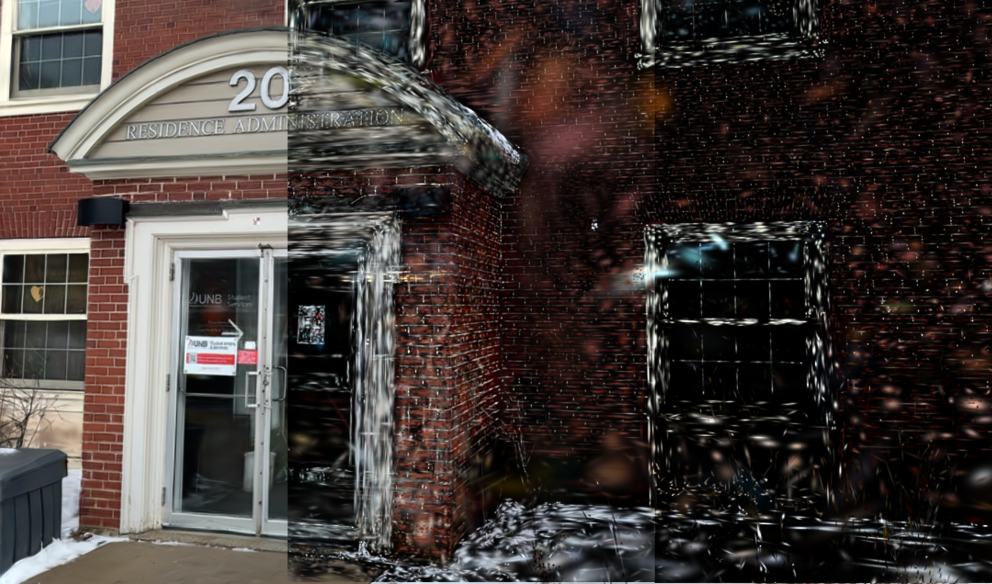
This image shows three renderings of a 3D model of the Residence Administration Building on the University of New Brunswick Fredericton campus. The first step towards creating this 3D model was to collect images with a phone and gimbal. These images were processed with computer vision techniques to create a sparse set of points and camera positions and orientations. Next, the 3D model (called a Gaussian splat) was created, where a scene is represented by a set of 3-dimensional probability density functions that look like blobs. Gaussian splatting was developed and made publicly available by Inria and the MPII. The size of the Gaussians in the three renderings was decreased in the middle and right panels to visualize model components. Gaussian splats have high visual quality and can even capture reflections and shadows. They are primarily evaluated through visual comparisons of renderings against input images. However, for my research, I am evaluating the spatial accuracy of Gaussian splatting for outdoor scenes. I am comparing the spatial accuracy of Gaussian splatting to terrestrial laser scanning, a conventional surveying technique. Once a baseline spatial accuracy is established, I plan on incorporating phone LiDAR to improve its spatial accuracy by constraining its geometry.